Our team are on hand to answer your enquiry. Let us know your questions, and a GroundTech expert will reach out to you.
- Free delivery over £195
- Delivery to UK & Ireland
- [email protected]
- 01366 500 828
- Manage my robot

See your surface from a new point of view with drone surveying from GroundTech.
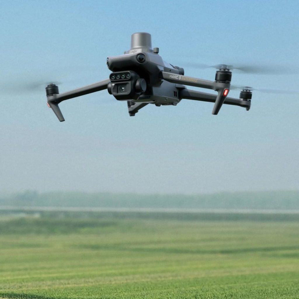
We’ve invested in the very best technology to be able to offer aerial surveys, bringing new levels of precision to your turf management. Combining 5 spectral bands with a high-resolution RGB camera, the drone collects detailed insights such as plant health to direct maintenance activities.
Whether you want to map drains, input data to better tailor spraying and nutritional applications or simply want to photograph your facility from above, get in touch and find out how GroundTech can help.
DJI Mavic 3 Multispectral
The DJI Mavic 3 Multispectral is a state-of-the-art aerial surveying drone designed for precision turf management. It combines advanced imaging technologies with robust flight features to provide comprehensive and accurate data for various applications.
Boasting a 5-band multispectral camera and covering up to 200 hectares per flight, it can generate pinpoint accurate maps for golf courses and sports pitches for targeted fertiliser spraying and optimised resource use.
DJI Mini 4 Pro
The DJI Mini 4 Pro is one of the most advanced mini-camera drone to date. It integrates powerful imaging capabilities, omnidirectional obstacle sensing, ActiveTrack 360° with Manual Mode and 20km FHD video transmission for superior imagery and effortless capture of intricate details.

Drone surveying provides innovative solutions for analyzing and maintaining grounds. Here are some resources to help you explore its benefits:
Our team are on hand to answer your enquiry. Let us know your questions, and a GroundTech expert will reach out to you.
GroundTech have found the right solution for all of these clients – get in touch and start a journey to transforming your business.

“
The Kress Mega that GroundTech provided on demonstration showed me the great capability of the machine, which was delivered very shortly after placing the order. Throughout the process, Marcus and the GroundTech team were responsive, highly communicative and professional: attributes which have already extended to their after-sales service.
Preservation Trust

“
Thank you to your team for doing a fantastic job with our pitch. My husband and many others really enjoyed seeing what your machine could do. I was very impressed with the result.
Kimbolton Football Club

“
We are lucky enough to be having a demo and trial of this little fella! Supplied by GroundTech, he’s going to be cutting the grass while we can get on with other grounds work. This might be one of the newest recruits!
Fakenham Racecourse

“
I am very happy with my Kress robotic mower. It obviously saves man hours cutting the grass but also because it is cutting every day there are no clippings left behind and the grass is improving as well. The mower will operate over 24 hours but I’ve currently got it set for 12 hours during the day as that is what works for us, there is also a rain delay setting if required.
Private Domestic Client

“
The automowers have come into their own over the last few months, saving us around 30-40 hours per week which has helped us focus on the improving other areas of the golf course that we previously couldn’t. We will be looking to add to our fleet in the coming months.
Brampton Heath Golf Centre

“
The quality of the cut and no arisings being left on the field at any time has led to positive feedback from all users of our main field. Any maintenance on the machines has been carried out efficiently. Very impressive all round and we are looking to secure funding to roll these out across the trust
Phil Burtsal from Sigma Trust

“
The club would like to thank GroundTech for their services today on marking out all our youth pitches ready for the start of the season. . If anyone needs this done then this company is the one to use . We as a club will be promoting this company within our partnership package
Thetford Town Football Club

“
I was impressed with the knowledge and expertise shown by the team which filled me with the confidence to go ahead. The level of service that followed, including the seamless install process and responsive aftercare, has left me confident I chose the right company to work with.
Private Domestic Client
Based in Norfolk and Suffolk, GroundTech supplies and installs commercial robot mowers and outdoor robotics across the UK. We support golf courses, sports clubs, schools, councils, large private estates and homeowners – backed by over 20 years of turf care and automation expertise.